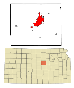
Salina, Kansas
| Salina, Kansas | |
|---|---|
| — City — | |
 |
|
 |
|
| Coordinates: | |
| Country | United States |
| State | Kansas |
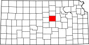
| County | Saline |
| Founded | 1858 |
| Incorporated | 1870 |
| Government | |
| - Type | Commission-manager |
| - City manager | Jason Gage |
| - Mayor | Aaron Peck |
| Area | |
| - Total | 22.8 sq mi (59.0 km2) |
| - Land | 22.7 sq mi (58.9 km2) |
| - Water | 0.0 sq mi (0.1 km2) |
| Elevation | 1,224 ft (373 m) |
| Population (2008) | |
| - Total | 46,483 |
| - Density | 2,033/sq mi (783.4/km2) |
| Time zone | Central (CST) (UTC-6) |
| - Summer (DST) | CDT (UTC-5) |
| ZIP codes | 67401-67402 |
| Area code(s) | 785 |
| FIPS code | 20-62700[1] |
| GNIS feature ID | 0476808[2] |
| Website | http://ci.salina.ks.us |
Salina (pronounced /səˈlaɪnə/) is a city in and the county seat of Saline County, Kansas, United States.[3] Located in one of the world's largest wheat-producing areas, it is the largest city in north-central Kansas and a regional trade center.[4] As of 2008, the city had an estimated population of 46,483.[1]
Contents |
History
Settlers led by journalist and lawyer William A. Phillips founded Salina in 1858. In the next two years, the territorial legislature chartered the town company, organized the surrounding area as Saline County, and named Salina the county seat. The westernmost town on the Smoky Hill Trail, Salina established itself as a trading post for westbound immigrants, prospectors bound for Pikes Peak, and area Native tribes. The town's growth halted with the outbreak of the American Civil War when much of the male population left to join the U.S. Army. In 1862, local residents fended off Native raiders only to fall victim to a second assault by bushwhackers later that year. Growth returned with the soldiers after the war, and, with the arrival of the Union Pacific Railroad in 1867, the town expanded rapidly. Salina was incorporated as a city in 1870.[5][6]
The cattle trade arrived in 1872, transforming Salina into a cowtown. The trade brought the city further prosperity, but also a rowdy culture that agitated local residents, and thus relocated westward just two years later.[7] During the 1870s, wheat became the dominant crop in the area, steam-powered flour mills were built, and agriculture became the engine of the local economy. In 1874, Salina resident E. R. Switzer introduced alfalfa to area farmers, and its cultivation began to spread throughout the state. By 1880, the city was an area industrial center with several mills, a carriage and wagon factory, and a farm implement works. Over the following decade, three railroads were built through the city.[8] The success of the wholesale and milling industries drove Salina's growth into the early 1900s such that, at one point, it was the third-largest producer in the state and the sixth-largest in the United States.[9]
In 1943, the U.S. Army established Smoky Hill Army Airfield southwest of the city. The installation served as a base for strategic bomber units throughout World War II. Renamed Smoky Hill Air Force Base in 1948, the base closed the following year only to be reopened in 1951 as Schilling Air Force Base, part of Strategic Air Command.[10] The re-opening of the base triggered an economic boom in Salina, causing the city's population to increase by nearly two-thirds during the 1950s.[9] The U.S. Department of Defense closed the base permanently in 1965, but the city of Salina subsequently acquired it and converted it into Salina Municipal Airport and an industrial park.[10] This led to substantial industrial development, attracting firms such as Beechcraft, and made manufacturing a primary driver of the local economy.[11]
In the decades since, Salina has continued to be the commercial hub of north-central Kansas, serving as a regional center for trade, transportation, and industry.[9][11]
Geography
Salina is located at (38.824267, -97.607205) at an elevation of 1,224 feet (373 m).[2][12] It lies in the Smoky Hills region of the Great Plains approximately 4 miles (6 km) west-southwest of the confluence of the Saline and Smoky Hill Rivers. The Smoky Hill River runs north then northeast through the eastern part of the city; the Saline River flows southeast immediately north of the city. Mulberry Creek, a tributary of the Saline, flows northeast through the far northern part of the city. Located in north-central Kansas at the intersection of Interstate 70 and Interstate 135, Salina is approximately 81 miles (131 km) north of Wichita and 164 miles (265 km) west of Kansas City.[13]
According to the United States Census Bureau, the city has a total area of 22.8 square miles (59.0 km²), of which, 22.7 square miles (58.9 km²) of it is land and 0.04 square miles (0.1 km²) of it (0.18%) is water.
Climate
Lying in the transition zone between North America's humid subtropical climate (Köppen Cfa) and humid continental climate (Köppen Dfa), Salina experiences hot, humid summers and cold, dry winters. The average temperature in Salina is 55 °F (13 °C), and the average relative humidity is 64%. Temperatures drop below 32 °F (0 °C) an average of 135 days per year. On average, Salina experiences 52 rainy days per year.[14] Precipitation averages 32.3 inches (820 mm) per year, and snowfall averages 18.4 inches (467 mm) per year.[15] On average, January is the coolest month, July is the warmest month, and May is the wettest month. The hottest temperature recorded in Salina was 117 °F (47 °C) in 1936; the coldest temperature recorded was −28 °F (−33 °C) in 1913.[16] Over the course of a year, temperatures range from an average low of 19 °F (−7 °C) in January to an average high of 93 °F (34 °C) in July.[17]
On September 25, 1973 a tornado measuring F3 passed through the southeast part of town injuring 6 people, destroying 2 houses and the Sundowner East trailer park.[18] On June 11, 2008 another EF3 tornado passed on the south side of the town severely damaging several buildings.[19]
| Climate data for Salina, Kansas, USA | |||||||||||||
|---|---|---|---|---|---|---|---|---|---|---|---|---|---|
| Month | Jan | Feb | Mar | Apr | May | Jun | Jul | Aug | Sep | Oct | Nov | Dec | Year |
| Source: The Weather Channel;[17] National Weather Service [16][20] | |||||||||||||
Demographics
| Historical populations | |||
|---|---|---|---|
| Census | Pop. | %± | |
| 1870 | 918 |
|
|
| 1880 | 3,111 | 238.9% | |
| 1890 | 6,149 | 97.7% | |
| 1900 | 6,074 | −1.2% | |
| 1910 | 9,688 | 59.5% | |
| 1920 | 15,085 | 55.7% | |
| 1930 | 20,155 | 33.6% | |
| 1940 | 21,073 | 4.6% | |
| 1950 | 26,176 | 24.2% | |
| 1960 | 43,202 | 65.0% | |
| 1970 | 37,714 | −12.7% | |
| 1980 | 41,843 | 10.9% | |
| 1990 | 42,303 | 1.1% | |
| 2000 | 45,679 | 8.0% | |
| Est. 2008 | 46,483 | 1.8% | |
As of the U.S. Census in 2000, there were 45,679 people, 18,523 households, and 11,873 families residing in the city. The population density was 2,009.6 people per square mile (775.9/km²). There were 19,599 housing units at an average density of 862.2/sq mi (332.9/km²). The racial makeup of the city was 87.76% White, 3.57% Black or African American, 0.56% Native American, 1.96% Asian, 0.05% Pacific Islander, 3.78% from other races, and 2.32% from two or more races. Hispanic or Latino of any race were 6.71% of the population.
There were 18,523 households out of which 31.5% had children under the age of 18 living with them, 49.8% were married couples living together, 10.5% had a female householder with no husband present, and 35.9% were non-families. 30.1% of all households were made up of individuals and 11.3% had someone living alone who was 65 years of age or older. The average household size was 2.39 and the average family size was 2.98.
In the city the population was spread out with 25.9% under the age of 18, 10.0% from 18 to 24, 28.7% from 25 to 44, 21.1% from 45 to 64, and 14.3% who were 65 years of age or older. The median age was 35 years. For every 100 females there were 95.8 males. For every 100 females age 18 and over, there were 92.8 males.
The median income for a household in the city was $36,066, and the median income for a family was $45,433. Males had a median income of $31,250 versus $21,944 for females. The per capita income for the city was $18,593. About 6.7% of families and 9.6% of the population were below the poverty line, including 10.6% of those under age 18 and 9.2% of those age 65 or over.[1]
Salina's population was estimated to be 46,140 in the year 2006, an increase of 368, or +0.8%, over the previous six years.[21]
Salina is the principal city of the Salina Micropolitan Statistical Area, which includes all of Saline and Ottawa counties.[22]
Economy
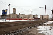
Manufacturing is the predominant industry in Salina.[23] Agriculture transportation is also a major industry,[24] and Salina's grain elevators are visible from miles away. This agrarian emphasis is even reflected in a local Catholic Church, Sacred Heart Cathedral, which is built in white cylindrical shapes intriguingly like grain silos.[25] However, Salina has several other important employers. The city also has a strong manufacturing base. Tony's Pizza, a Schwan Food Company brand, has operations in Salina.[26] Tony's makes consumer retail frozen pizzas as well as food intended for school cafeterias and other institutions.[26] Additionally, Philips Lighting,[27] Exide Battery,[28] Great Plains Manufacturing (farm equipment),[29] and ElDorado National (commercial bus manufacturer)[30] all have a presence in the community.
Government
Since 1921, Salina has had a commission-manager form of government. The city commission consists of five members elected at large, one of whom the commission annually selects to serve as mayor. Commission candidates who receive the most and second most votes are elected for a four-year term; the candidate who receives the third most votes is elected for a two-year term.[31] The commission sets policy and appoints the city manager. The city manager is the city's chief executive, responsible for administering the city government and appointing all city employees.[32]
Education
Colleges and universities
- Brown Mackie College
- Kansas State University - Salina
- Kansas Wesleyan University
- Salina Area Technical College (formerly operated by USD305 as Salina Area Technical School)
Primary and secondary education
Salina Public Schools (Unified School District 305) operates twelve schools in Salina:[33][34]
|
|
There are also four private schools in Salina:[33]
- St. John's Military School (6-12), male only[35]
- St. Mary's Grade School (Pre-K-6), Catholic school
- Salina Christian Academy (Pre-K-10)[36]
- Sacred Heart Junior-Senior High School (7-12), Catholic school
Transportation

Interstate 70 and U.S. Route 40 run concurrently east-west north of Salina. Interstate 135 and U.S. Route 81 run concurrently north-south along the west side of the city. The I-70/I-135 interchange northwest of the city is the northern terminus of I-135. K-140, which approaches Salina from the southwest, formally ends at its interchange with I-135 before entering the city as State Street. North of Salina, the city's main north-south thoroughfare, Ninth Street, becomes K-143 at its interchange with I-70.
CityGo is the local public transport bus service, operating three routes in the city. CityGo also provides intercity bus service to surrounding communities as NCK Express. Greyhound Lines provides long-distance bus service.[37]
Salina Municipal Airport is located immediately southwest of the city. Used primarily for general aviation, it hosts one commercial airline under the Essential Air Service program.
The Kansas Pacific (KP) Line of the Union Pacific Railroad runs northeast-southwest through the northern part of the city.[38] Salina is also the southeastern terminus of the Salina Subdivision of the Kansas and Oklahoma Railroad.[39]
Media
Salina has one daily newspaper, The Salina Journal.[40]
Radio
AM
| Frequency | Callsign[41] | Format[42] | City of License | Notes |
|---|---|---|---|---|
| 550 | KFRM | News/Talk | Salina, Kansas | Broadcasts from Clay Center, Kansas |
| 910 | KINA | News/Talk | Salina, Kansas | - |
| 1150 | KSAL | News/Talk | Salina, Kansas | - |
FM
| Frequency | Callsign[43] | Format[42] | City of License | Notes |
|---|---|---|---|---|
| 88.5 | KAKA | Christian | Salina, Kansas | AFR |
| 89.5 | KHCD | Public | Salina, Kansas | NPR; Satellite of KHCC-FM, Hutchinson, Kansas |
| 91.7 | KCVS | Christian | Salina, Kansas | - |
| 92.7 | KZUH | Sports | Minneapolis, Kansas | Broadcasts from Salina |
| 93.7 | KYEZ | Country | Salina, Kansas | - |
| 95.5 | KVOB | Adult Hits | Lindsborg, Kansas | Jack FM; Broadcasts from Salina |
| 96.5 | K243BD | Contemporary Christian | Salina, Kansas | Translator of KJRL-FM, Herington, Kansas[44] |
| 99.9 | KSKG | Country | Salina, Kansas | - |
| 101.7 | KDJM | Country | Lindsborg, Kansas | Broadcasts from Salina |
| 104.9 | KSAL-FM | Classic Hits | Salina, Kansas | - |
| 107.1 | K296FD | Christian | Salina, Kansas | Translator of KCCV-FM, Olathe, Kansas |
Television
Salina is part of the Wichita television market, which covers much of the central and western part of Kansas. Cox Communications is the main cable system serving Salina. The following television stations are licensed to Salina:
| Digital Channel | Analog Channel | Callsign[45] | Network | City of License | Notes |
|---|---|---|---|---|---|
| - | 15 | K15CN | TBN | Salina, Kansas | TBN satellite repeater |
| 17 | - | KAAS-TV | Fox | Salina, Kansas | Satellite of KSAS-TV, Wichita, Kansas |
| - | 41 | KSKV-LP | - | Salina, Kansas | - |
| 47 | - | KSNL-LD | NBC | Salina, Kansas | Satellite of KSNW, Wichita, Kansas |
| - | 51 | KHDS-LP | ABC | Salina, Kansas | Satellite of KAKE-TV, Wichita, Kansas |
Culture
Religion
56% of Salina residents are affiliated with a religious congregation. The majority are Christian, and the Roman Catholic Church, United Methodist Church, and Evangelical Lutheran Church in America are the three largest denominations in the city.[33] Salina has 90 churches and is the seat of the Roman Catholic Diocese of Salina, Episcopal Diocese of Western Kansas, and the Presbytery of Northern Kansas.[46][47]
Sports
- Salina formerly hosted the Kansas Cagerz and Salina Rattlers basketball teams.
- Salina hosts the National Junior College Athletic Association Division I women's basketball national tournament each season in the Bicentennial Center.
- Salina hosted the Women's Big 8 basketball tournament at the Bicentennial Center. When the Big 8 became the Big 12, the tournament was moved to Kansas City, Missouri.
- Salina hosts the Kansas State High School Activities Association (KSHSAA) Class 4A State Wrestling Tournament as well as the Class 3A & 4A Volleyball Tournaments and the Class 4A State Softball Tournament.
In popular culture
- The 1980 teen comedy film Up the Academy was filmed entirely in Salina, mostly on the campus of St. John's Military School.[48]
- Scenes in the 1955 movie Picnic, starring William Holden and Kim Novak, were filmed in Salina (arrival of the train at the beginning of the movie, The Bensons' mansion)
- Millie Dillmount, the fictional main character in the musical Thoroughly Modern Millie, is from Salina. She leaves home for New York City, determined never to return, as depicted in the opening number, "Not for the Life of Me."
- In Alfred Hitchcock's 1958 film Vertigo, the character of Judy Barton, played by Kim Novak, comes from Salina.
- Bluegrass band The Avett Brothers have a song titled "Salina."
- In Shawn Colvin's song, "Wichita Skyline" (from the 1996 album A Few Small Repairs), she sings "As far as Salina I can get that good station from LaRue / I'm searching the dial while I'm scanning the sky for a patch of blue / And I watch the black clouds roll in, chasing me back again / Back to the flat fine line, the Wichita skyline." However, she mispronounces the city as sa-LEE-na, as in Salinas, CA. (LaRue is in Texas.)
- The Cowboy Junkies song "Townes' Blues" (from the 1992 album Black Eyed Man) describes a trip from Boulder, CO to Houston, TX through Salina, though Canadian lead singer Margo Timmins also pronounces the city's name like Salinas, CA.
- The invitational supergroup The Book of Knots have a song entitled "Salina" on their sophomore album Traineater.
- Salina was largely destroyed in Ted Bell's 2008 novel Tsar, with only a Motel Six hotel, a park, and the surrounding area surviving. It was destroyed by a Russian bomber posing as an Iranian terrorist. The mayor had been assassinated a few days before the explosion.
Notable natives and residents
|
|
References
- ↑ 1.0 1.1 1.2 "American FactFinder". United States Census Bureau. http://factfinder.census.gov. Retrieved 2008-01-31.
- ↑ 2.0 2.1 "US Board on Geographic Names". United States Geological Survey. 2007-10-25. http://geonames.usgs.gov. Retrieved 2008-01-31.
- ↑ "Find a County". National Association of Counties. http://www.naco.org/Template.cfm?Section=Find_a_County&Template=/cffiles/counties/usamap.cfm. Retrieved 2008-01-31.
- ↑ "About Salina". City of Salina, Kansas. http://www.salina-ks.gov/content/120/default.aspx. Retrieved 2010-07-10.
- ↑ Blackmar, Frank W., ed (1912). "Salina". Kansas: a cyclopedia of state history, embracing events, institutions, industries, counties, cities, towns, prominent persons, etc.. 2. Chicago: Standard. pp. 634-635. http://skyways.lib.ks.us/genweb/archives/1912/s/salina.html.
- ↑ Blackmar, Frank W., ed (1912). "Saline County". Kansas: a cyclopedia of state history, embracing events, institutions, industries, counties, cities, towns, prominent persons, etc.. 2. Chicago: Standard. pp. 635-639. http://skyways.lib.ks.us/genweb/archives/1912/s/saline_county.html.
- ↑ Cutler, William G. (1883), "Salina, Part 1", History of the State of Kansas, Chicago: A.T. Andreas, http://www.kancoll.org/books/cutler/saline/saline-co-p4.html#SALINA_P1
- ↑ Works Projects Administration (1949). Kansas: A Guide to the Sunflower State. New York: Hastings House. p. 273.
- ↑ 9.0 9.1 9.2 "Salina History". City of Salina, Kansas. http://www.salina-ks.gov/content/120/144/default.aspx. Retrieved 2010-07-10.
- ↑ 10.0 10.1 "SAC Bases: Smokey Hill / Schilling AFB". Strategic-Air-Command.com. http://www.strategic-air-command.com/bases/Schilling_AFB.htm. Retrieved 2010-07-17.
- ↑ 11.0 11.1 "Narrative". Salina Area Chamber of Commerce. 2008. http://www.salinakansas.org/ecodevo/narrative.asp. Retrieved 2010-07-17.
- ↑ "US Gazetteer files: 2000 and 1990". United States Census Bureau. 2005-05-03. http://www.census.gov/geo/www/gazetteer/gazette.html. Retrieved 2008-01-31.
- ↑ "City Distance Tool". Geobytes. http://www.geobytes.com/citydistancetool.htm. Retrieved 2010-03-13.
- ↑ "Historical Weather for Salina, Kansas, United States of America". Weatherbase. http://www.weatherbase.com/weather/weatherall.php3?s=45427&refer=&units=us. Retrieved 2009-12-19.
- ↑ "NOWData - NOAA Online Weather Data". National Weather Service Forecast Office - Wichita, KS. http://www.weather.gov/climate/xmacis.php?wfo=ict. Retrieved 2010-02-27.
- ↑ 16.0 16.1 "National Weather Service". National Oceanic & Atmospheric Administration. http://www.crh.noaa.gov/ict/climate/viewrecords.php. Retrieved 2010-07-18.
- ↑ 17.0 17.1 "Average weather for Salina, KS". The Weather Channel. http://www.weather.com/weather/wxclimatology/monthly/graph/USKS0523. Retrieved 2010-02-27.
- ↑ Barbara Phillips (September 27, 1973). "Tornadoes take heavy Kansas toll". Salina Journal: p. 2.
- ↑ Lawson, Rob (2008-06-12). "June 11th, EF-3 Tornado and Extremely Large Hail Slam Central Kansas". Wichita National Weather Service News Archives. National Weather Service Wichita, Kansas. http://www.crh.noaa.gov/ict/scripts/viewstory.php?STORY_NUMBER=2008061206. Retrieved 2010-03-13.
- ↑ "National Weather Service". National Oceanic & Atmospheric Administration. http://www.crh.noaa.gov/ict/scripts/displayNormals.php. Retrieved 2010-07-18.
- ↑ "Population Estimates". U.S. Census Bureau, Population Division. http://www.census.gov/popest/estimates.php. Annual estimates of the population to 2006-07-01. Released 2007-06-28. Population change is from 2000-07-01 to 2006-07-01.
- ↑ "Updates to Statistical Areas; Office of Management and Budget". Executive Office of the President, Office of Management and Budget. November 20, 2008. http://www.whitehouse.gov/omb/assets/omb/bulletins/fy2009/09-01.pdf. Retrieved October 28, 2009.
- ↑ Saline County Emergency Management (2009-02). "It Can Happen Here". A Study of the Hazards affecting Saline County, Kansas and their effects on the Community. Saline county Emergency Management. p. 11. http://www.saline.org/LinkClick.aspx?fileticket=Z8P7udAKSbk%3d&tabid=4349&mid=7044.
- ↑ Saline County Emergency Management (2009-02). "It Can Happen Here". A Study of the Hazards affecting Saline County, Kansas and their effects on the Community. Saline county Emergency Management. p. 17. http://www.saline.org/LinkClick.aspx?fileticket=Z8P7udAKSbk%3d&tabid=4349&mid=7044.
- ↑ "Architecture". Sacred Heart Cathedral. http://www.shcathedral.com/Architecture.htm. Retrieved 2010-04-04.
- ↑ 26.0 26.1 The Schwan Food Company (2007). "Communities of Operation". theschwanfoodcompany.com. The Schwan Food Company. http://web.archive.org/web/20080409173224/http://www.theschwanfoodcompany.com/about_comm.cfm. Retrieved 2010-03-13.
- ↑ Phillips Lighting (2009-06). "An energy saving solution for government facilities...". Phillips Lighting. http://www.search.philips.com/search/jsp/clickout.jsp?clicklocation=1&type=searchhit&text=Salina,%20Kansas§ion=lighting&locale=us_en&url=http://www.lighting.philips.com/us_en/browseliterature/download/p-6018.pdf. Retrieved 2010-03-13.
- ↑ Exide Technologies. "Exide's Worldwide Facilities". exide.com. Exide Technologies. http://www.exide.com/portal/server.pt/community/locations_community/214. Retrieved 2010-03-17.
- ↑ Great Plains Manufacturing. "Great Plains Contact Information". greatplainsmfg.com. Great Plains Manufacturing. http://www.greatplainsmfg.com/contactus/contactus.html. Retrieved 2010-03-17.
- ↑ Web Creations and Consulting (2006). "About the Company". enconline.com. ElDorado National. http://www.enconline.com/company.cfm. Retrieved 2010-03-17.
- ↑ "City Commission". City of Salina, Kansas. http://www.salina-ks.gov/content/122/default.aspx. Retrieved 2010-02-27.
- ↑ "City Government". City of Salina, Kansas. http://www.salina-ks.gov/content/132/default.aspx. Retrieved 2010-02-27.
- ↑ 33.0 33.1 33.2 "Salina, Kansas". City-Data.com. http://www.city-data.com/city/Salina-Kansas.html. Retrieved 2010-02-28.
- ↑ "Salina USD 305 School Websites and Handbooks". Salina USD 305. https://www.usd305.com/schoolweb/index.html. Retrieved 2010-02-28.
- ↑ "About St. John's Military School". St. John's Military School. http://www.sjms.org/about/. Retrieved 2010-02-28.
- ↑ "Welcome". Salina Christian Academy. http://www.salinachristianacademy.org/welcome.asp. Retrieved 2010-02-28.
- ↑ "Locations: Kansas". Greyhound Lines. http://www.greyhound.com/home/TicketCenter/en/locations.asp?state=ks. Retrieved 2010-05-08.
- ↑ "UPRR Common Line Names". Union Pacific Railroad. http://www.uprr.com/aboutup/maps/attachments/upcomnam.pdf. Retrieved 2010-05-08.
- ↑ "Kansas & Oklahoma Railroad - Detailed Map". Watco, Inc.. http://www.watcocompanies.com/railroads/ko/ko_map.htm. Retrieved 2010-05-08.
- ↑ "About this Newspaper: The Salina journal". Chronicling America. Library of Congress. http://chroniclingamerica.loc.gov/lccn/sn82015075/. Retrieved 2009-09-13.
- ↑ "AMQ AM Radio Database Query". Federal Communications Commission. http://www.fcc.gov/mb/audio/amq.html. Retrieved 2009-09-13.
- ↑ 42.0 42.1 "Station Information Profile". Arbitron. http://www.arbitron.com/radio_stations/station_information.htm. Retrieved 2009-09-13.
- ↑ "FMQ FM Radio Database Query". Federal Communications Commission. http://www.fcc.gov/mb/audio/fmq.html. Retrieved 2009-09-13.
- ↑ "KJRL-FM 105.7 MHz". Radio-Locator. Theodric Technologies LLC. http://www.radio-locator.com/cgi-bin/finder?sr=Y&call=KJRL. Retrieved 2009-09-13.
- ↑ "TVQ TV Database Query". Federal Communications Commission. http://www.fcc.gov/fcc-bin/audio/tvq.html. Retrieved 2009-09-13.
- ↑ "Statistical Data". City of Salina, Kansas. http://www.salina-ks.gov/content/120/146/default.aspx. Retrieved 2010-07-18.
- ↑ "About Us". Presbytery of Northern Kansas. http://www.pnks.org/pAboutUs.aspx. Retrieved 2010-07-18.
- ↑ Internet Movie Database
External links
- City website
- Chamber of Commerce website
- Salina Local News
- 1150am KSAL
- Y93.7
- The Salina Journal Newspaper
- Special Collections: A gift of William A. Phillips, the founder of Salina
|
|||||||||||||||||
|
|||||||||||||||||